


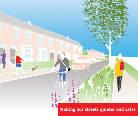
 The revised proposals for a low-traffic neighbourhood based around Fox Lane are expected imminently. In the meantime Enfield Council has launched the next phase of the Quieter Neighbourhoods programme by setting up perception surveys for the three residential areas that are included in Phase 2.
In terms of the "processes and phases" that were announced in August, this means that the Fox Lane scheme is about to move into stage 3 - a public event to explain the plans and an opportunity for residents to comment - while the three Phase 2 schemes are at stage 1 - asking residents to share their ideas on problems and potential solutions in their area. These were all scheduled for "late summer 2019", so it looks as if the programme has slipped somewhat.
Where are we at with the Fox Lane scheme?
Residents in the Fox Lane Quieter Neighbourhood should have leaflets about the scheme put through their doors next week, starting on Tuesday. These will include details of an engagement event in Palmers Green where people can share their thoughts about the proposals, but it will also be possible to comment online.
The current plan is to implement the proposals on a trial basis, probably for six months, to allow all interested parties to assess how well the scheme works. Formal consultation will take place during the trial. (More information and a chance to subscribe to updates is at letstalk.enfield.gov.uk/foxlaneQN.)
What areas are in Phase 2?
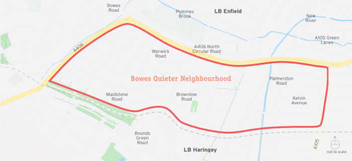
- Bowes Park - covering all streets in Bowes ward south of Bowes Road between Pinkham Way to the west and Green Lanes to the east
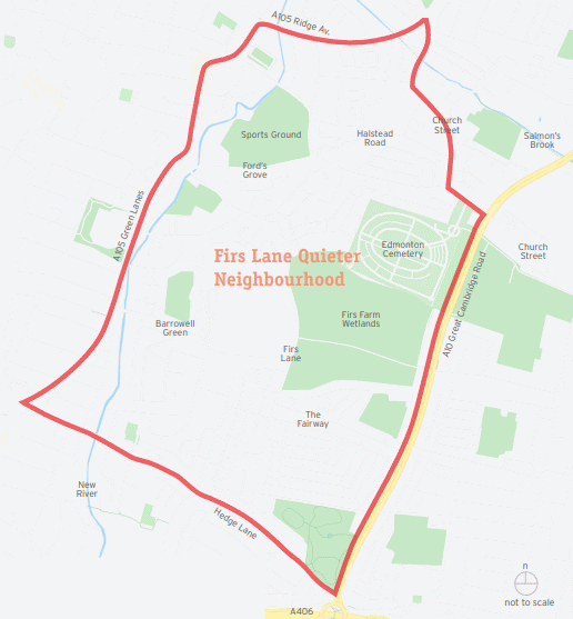
- Firs Lane - covering a large area between Green Lanes and the Great Cambridge Road, from Hedge Lane in the south to Church Street and Ridge Avenue to the north.
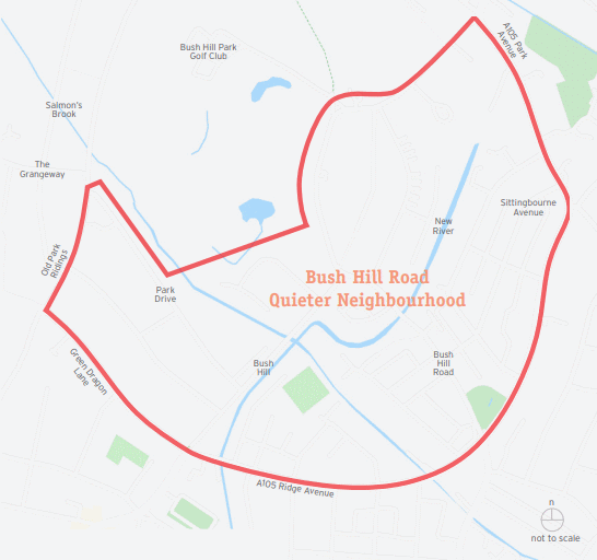
- Bush Hill Road - a crescent-shaped area north of Ridge Avenue and west of the A105 with the intersection between Bush Hill and Bush Hill Road at its centre.
Perception surveys
The perception surveys for all three areas run until 10th November and are intended to find out what issues people living in them have with traffic speed and volumes, noise, difficulty in crossing roads, car parking, congestion and road danger. The council will use the results when devising proposals for the quieter neighbourhoods.
Links
Let's Talk Enfield Neighbourhoods Hub (with links to all information and perception surveys)
Council outlines new Quieter Neighbourhoods Strategy (PGC 27 August 2019)